|
High water table and groundwater recharge areas.
North Courtice circled in light blue
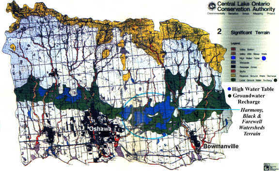
High water table areas = blue
Groundwater recharge areas = dark green
(Note: See Old Lake Iroquois and Lake Iroquois History for location of Lake Iroquois; Oak Ridges
Morraine area is shown in Yellow.)
Groundwater MYTH:
groundwater is separate from streams,lakes and wetlands
REALITY: Groundwater is
part of the drainage system that maintains the supply of water in streams,lakes and
wetlands
Some High Water Table areas in North
Courtice:
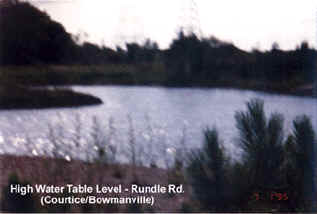
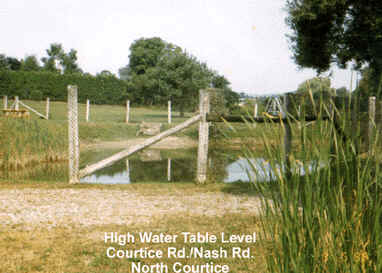
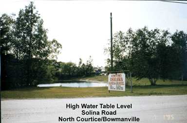
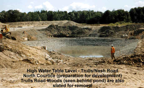
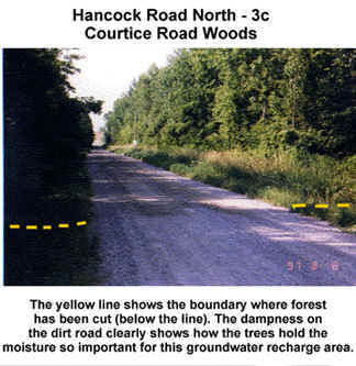
It's easy to see the high water table and
groundwater recharge areas so evident on the map and in the photos. Almost ALL of North
Courtice is a Groundwater recharge and high water table area. One of the few remaining in
South/Central Ontario. (But for how long, with all the development and infilling
continuing...)
Back to
Map Links
[Home] [Site Map] [Who We Are] [Black-Farewell] [Black Creek 2001] [Local Wetlands] [What is a Wetland] [Our Watershed] [Map Links] [Current Events] [Studies] [MOEE Tips] [Photo Gallery] [Lake Iroquois] [Responsibility] [Govt. Contacts] [Enviro Links] [Message Forum] |