|
SIGNIFICANT FOREST & WILDLIFE AREAS
North Courtice Area circled in blue; as
compared to other areas
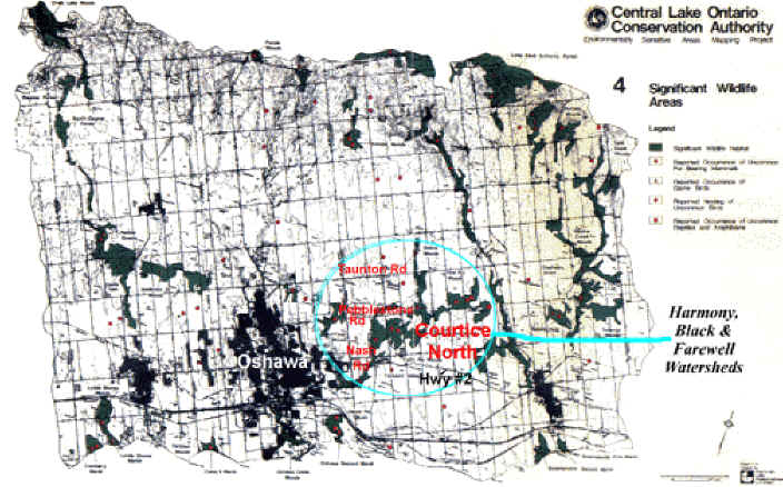
Dark Green = Significant wildlife habitat
Red dots = reported occurences of uncommon
Fur-Bearing Animals, Birds, Reptiles/Ampibians
Black Areas = "dead" areas of heavy
population/development
You can easily see the higher sensitivity within
our farewell/Black Creek watershed as compared to other areas within the map area.
Back to
Map Links
[Home] [Site Map] [Who We Are] [Black-Farewell] [Black Creek 2001] [Local Wetlands] [What is a Wetland] [Our Watershed] [Map Links] [Current Events] [Studies] [MOEE Tips] [Photo Gallery] [Lake Iroquois] [Responsibility] [Govt. Contacts] [Enviro Links] [Message Forum] |